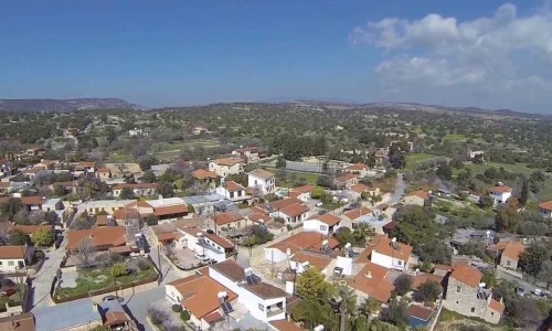
Moniatis Village
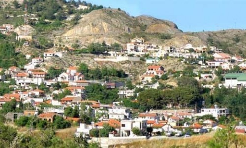
The village of Moniatis is situated 30 kilometres northwest of Limassol, at an altitude of 730 metres above the surface of the sea. To the east, it borders with the village of Pelendri, to the north with Amiantos, to the northwest with Platres, to the southwest with Pera Pedi, and to the south with Kouka and Trimiklini.
Name
There are two versions in relation to the name of the village:
- The first version states that the residents of the village came from a monastery. This monastery is possibly the Monastery of Timiou Prodromou in Mesa Potamo, or the Monastery of Timio Stavrou in Kouka.
- The second version is that there were shepherds who herded their sheep there. It was the area where the flock ended up to rest.
History
Moniatis appears on the Venetian maps. George Voustronios mentions that it as a feud of Alexander Kappadoki. Florios Voustronious mentions that between 1464 and 1468 Moutio De Kostanzo owned the feud.
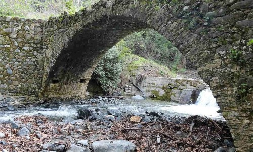
A river goes through the village, which divides the Greek from the Turkish community of the village.
Population
According to the population inventory that occurred on the island, the village population met many increases and decreases. Until 1963, Moniatis was a mixed village where both Greek Cypriots and Turkish Cypriots lived together. Between 1946 and 1960 many Turkish Cypriots abandoned the village. During the intercommunal riots between 1963-1964 , all the Turkish Cypriots abandoned the village and settled in the Turkish Cypriot area in Limassol. Some returned to their villages in 1968. After the Turkish invasion in 1974, the Turkish Cypriots from Moniati who lived in Limassol were transferred to the north side of the island. The only residents left in Moniatis were Greek Cypriots, while some Greek Cypriot refugees also settled there. During the last inventory, the population of the village shows an increasing tendency. Today there are about 350 permanent residents, which reach 2.500 during the summer months.
Churches and chapels
Moniatis has five churches. The first one is situated in Mesa Potamo where the historical monastery of Timiou Prodromou is. The monastery is dated from 1468. The monastery was built during the byzantine period, in particular during the 12th century, which is also when, the rest of the monasteries in the area were built. The icon of the Zoodochou Pigi Saittiotissas, which is dated to the 12th century, can also confirm this date.
Moniatis has five churches. The first one is situated in Mesa Potamo, where the historical Monastery of Timiou Prodromou is located and is dated from 1468. According to the author of the book Moniatis, the monastery is dated to the Byzantine period, in particular the 12th century, which is also when, the rest of the monasteries in the area were built. This date is confirmed in the writings of the Archimandrite Epifanios and the icon of the 12th century Zoodochou Pigi Saittiotissas.
The particular icon was transferred to the Timios Stavros Church in the neighbouring village of Kouka in 1914. The decision to transfer the icon was made by the Metropolite Meletio Metaxaki when the Monastery was destroyed. In 2003, the icon was then taken to the Holy Metropolis of Limassol. It must also be noted that in 1914 the Monastery was transformed into a hotel.
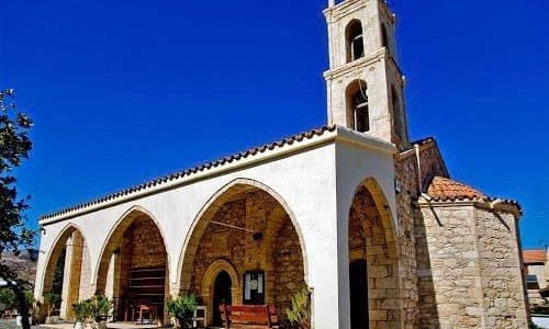
A second church dedicated to the Archangel Michael, with the unique crucifixion dated to the 18th century, was restored by the Department of Antiquities. The Panagia Odigitra Church is the main church in the village. The two chapels situated in the village are dedicated to Prophet Elias and Zoodocho Pigi.
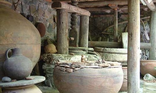
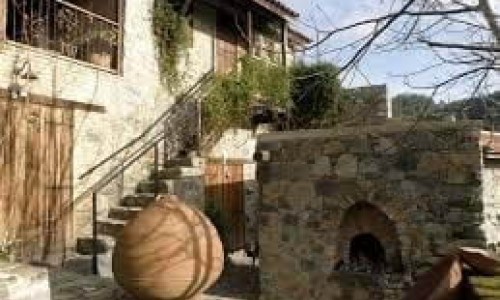
Museum of Folk Art
The Museum of Folk Art is situated in the centre of the village. The operation of the museum is made up of two basic operation sections. The first concerns the ground floor with the foyer, a viewing area and two display areas. The second operational section covers the premises where the live exhibition of traditional occupations will be set up.