Mesa Potamos Waterfall
Tucked away in the verdant folds of Cyprus' Troodos Mountains lies a natural sanctuary that remains blissfully untouched by mass tourism: Mesa Potamos Waterfall. Also known as "Mesapotamos," this serene cascade offers a peaceful escape into nature, just a short drive from the popular mountain resort village of Platres. With its crystal-clear waters, shaded trails, and cool mountain air, Mesa Potamos is a must-visit for travelers looking to unplug, unwind, and discover one of the island’s lesser-known treasures.
Mesa Potamos Waterfall is located in the Limassol District of Cyprus, within the Troodos mountain range. It's about 45 minutes from Limassol city by car and just a few kilometers from Platres—a charming alpine village famous for its cool climate, scenic views, and colonial-era charm.
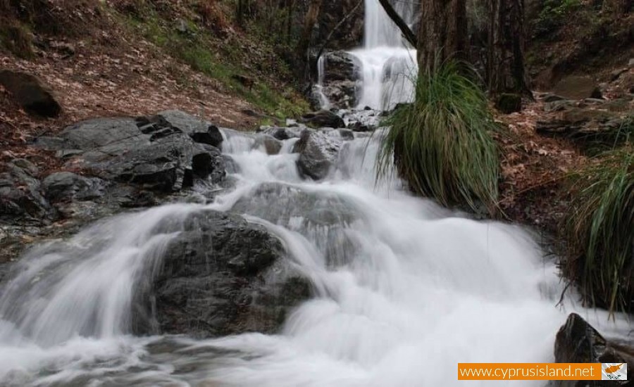
The waterfall sits at an altitude of approximately 1,000 meters and is part of the Kouris River system. Its name, “Mesa Potamos,” means "Middle River" in Greek, referencing its position among the network of streams and rivers crisscrossing the Troodos slopes.
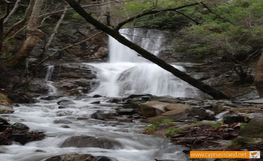
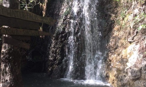
Unlike some waterfalls that require a grueling hike, the path to Mesa Potamos is relatively easy and short. From the designated parking area near the Mesa Potamos picnic site, it’s about a 5–10-minute walk down a well-marked trail. The trail meanders through a pine and oak forest, with fresh scents of wild herbs and the gentle rustle of leaves underfoot. It’s peaceful, shady, and ideal for families, solo travelers, or couples seeking a romantic nature retreat.
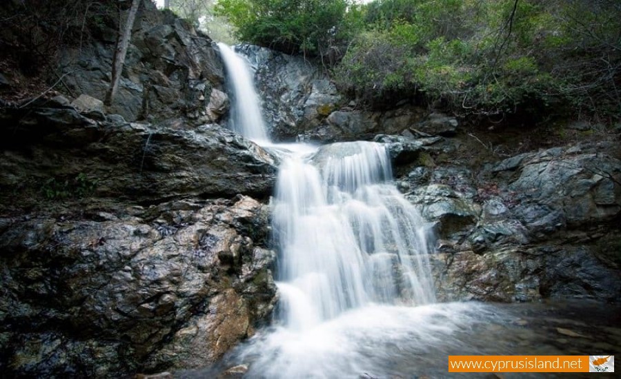
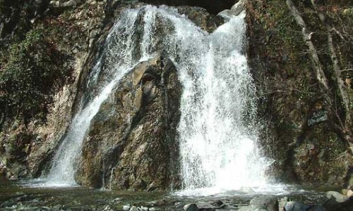
As you approach, the sound of cascading water grows louder, building anticipation. The waterfall itself, while not massive in height—around 7 meters (23 feet)—is absolutely picturesque. The water tumbles over a dark, moss-covered rock wall into a shallow, cool pool, creating a scene worthy of a fairytale.
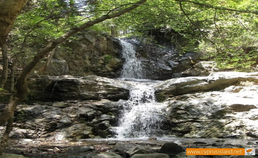
Spring and early summer (March to June) are arguably the best times to visit Mesa Potamos. The waterfall flows most vigorously during these months thanks to snowmelt from the surrounding mountains. Autumn (September–November) is another great option, offering golden foliage and fewer crowds.
In the heat of summer, the area is a cool refuge, though the water flow may be reduced. Winter visits are also possible and bring a different kind of magic, with misty air, chilly temperatures, and the potential for light snow.
What to Do There
- Picnicking: The nearby Mesa Potamos Picnic Site is well-equipped with benches, barbecue areas, and trash bins, making it an excellent place for an al fresco meal amid the trees.
- Photography: Nature lovers and Instagrammers alike will find plenty of inspiration. The waterfall, the surrounding forest, and even the trail offer photogenic moments throughout.
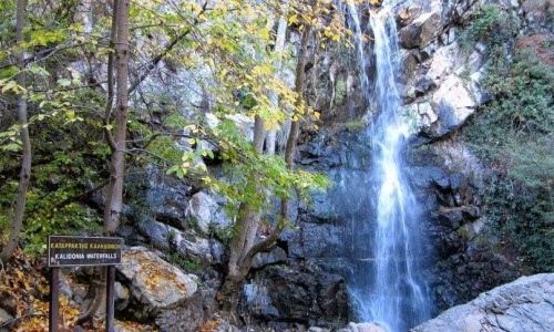
- Hiking & Exploring: You can combine your visit with a walk on the Kalidonia Nature Trail or other Troodos paths if you're up for more adventure.
- Meditation & Relaxation: With the sound of running water and birdsong all around, it's a perfect spot for mindful breathing, meditation, or quiet reflection.
Nearby Attractions
- Trooditissa Monastery – Just a short drive away, this 13th-century Orthodox monastery is perched on a forested hillside and offers rich history and stunning views.
- Millomeris Waterfall – If you’re chasing waterfalls, another beautiful site near Platres, Millomeris is taller and more dramatic, but often more crowded.
- Omodos Village – A picturesque wine-producing village with cobbled streets, traditional taverns, and a historic monastery.
- Platres – Whether you're after a spa day, local sweets, or just a cool place to stroll in summer, Platres is a great base for exploring the Troodos.
Tips for Visitors
- Footwear: Wear sturdy shoes with good grip—the path can be slippery, especially after rain.
- Safety: Don’t attempt to climb the rocks or dive into the pool; the area is not supervised, and wet surfaces can be treacherous.
- Respect Nature: Pack out your trash, stay on marked trails, and respect local wildlife.
- Timing: Visit early in the day or during weekdays to avoid crowds, especially in peak tourist seasons.
Mesa Potamos Waterfall may not be the biggest or the most famous in Cyprus, but it offers something far more special: a sense of discovery. Here, nature whispers rather than roars, and every rustling leaf or trickle of water feels like part of a secret shared only with those who truly seek it. Whether you're a nature lover, a casual hiker, or simply someone in search of tranquility, Mesa Potamos is a gentle reminder of the quiet beauty that still exists in the heart of the island.
So if your travels take you to the Troodos Mountains, don’t just stick to the well-trodden paths. Take a detour, follow the forest trail, and let the sound of water guide you to one of Cyprus' best-kept secrets