Paphos Old Town (Ktima)
Above the glittering sea and the hotel-laden coastal strip of Kato Paphos lies Ktima, the historic heart of the city and a living tapestry woven from centuries of Cypriot life. Known to locals simply as “Pano Paphos” (Upper Paphos), Ktima feels like a world apart—less hurried, more textured, and deeply connected to the island’s soul.
For decades, Ktima was overlooked—its faded mansions and sleepy streets passed by in favor of beachfront attractions. But that neglect preserved its authenticity. And now, following an ambitious wave of restoration, the town has reemerged as a vibrant, cultural district, brimming with art, food, history, and a rediscovered sense of identity.
A Deeper Historical Perspective
To understand Ktima is to understand Cyprus itself—a place where empires have come and gone, each leaving their mark.
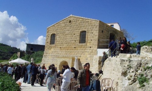
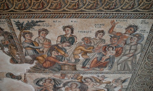
While Kato Paphos dates to the Greco-Roman era with its mosaics and amphitheater, Ktima developed more prominently in the medieval and modern periods. It rose in importance under Ottoman rule, when administrative functions and trade began moving inland. During the British colonial era (1878–1960), Ktima became the bureaucratic and cultural capital of the district. Elegant colonial buildings were erected, courts established, and schools built. Many of these structures still stand, weathered but dignified, lining the town’s core.
The town’s population was historically a blend of Greek and Turkish Cypriots, living side by side in mixed neighborhoods. Their departure during the political upheavals of the 1960s and 1970s left behind empty buildings and memories etched into doorways and stones. Today, some of these spaces have been reinhabited and repurposed, often as boutiques, galleries, or cafes, giving new life to old walls.
The Ktima Renaissance: Culture at the Core
Paphos’s designation as a European Capital of Culture in 2017 was a turning point. It sparked a cultural awakening that transformed Ktima from a sleepy quarter into a creative nucleus.
Old facades were restored, neglected squares revamped, and public art installations commissioned across the town. Today, you’ll find open-air stages, poetry etched into pavements, and murals that tell forgotten stories. The revival was not cosmetic—it was deeply philosophical. It was about reclaiming public space, reconnecting people to place, and giving local voices a platform.
This cultural shift also encouraged a younger generation to return—artists, chefs, writers, and designers—who are now the driving force behind Ktima’s renewed energy.
An Expanded Walking Experience: From Squares to Side Streets
To fully appreciate Ktima, you need to wander without a plan. Start at Kennedy Square, the town’s civic hub, where elderly men still gather on benches under jacaranda trees and teenagers play music on the steps of the old town hall. Nearby, the Municipal Library, housed in a neoclassical building, is a peaceful spot to explore local literature, with a small exhibition space for Cypriot artists.
From here, venture into the side streets, where you’ll discover:
- Makarios Avenue, lined with boutique shops and antique stores—some dating back generations.
- Votsi Street, where pastel-colored houses have been turned into artist studios and concept stores.
- Ivis Maliotou Park, a small but lush public garden that hosts cultural events and offers welcome shade in summer.
Each street seems to unfold with surprise—a ceramicist’s open workshop, a flower-covered archway, a cafe with vinyl records spinning and elderly women playing tavli (backgammon).
People and Traditions: The Living Soul of Ktima
What truly sets Ktima apart is its people. Unlike the more transient feel of tourist-heavy zones, Ktima is a lived-in town, where generations still gather for afternoon coffee and where shopkeepers greet you by name if you return more than once.
You’ll meet:
- Yiannis, who handcrafts leather sandals in the same shop his grandfather opened in the 1930s.
- Maria, who runs a tiny kitchen where she makes kolokotes (pumpkin pies) using her grandmother’s recipe, wrapped in wax paper.
- Andreas, a local photographer who exhibits his black-and-white portraits in the window of his old studio.
These everyday people embody the resilience, warmth, and creative spirit of the town.
Food & Drink: Slow, Seasonal, and Local
The culinary scene in Ktima has blossomed into a showcase of slow food and local flavor.
For traditional meze, Laona remains a favorite—unpretentious, affordable, and always delicious. Try the stuffed courgette flowers or the pork afelia. For a modern twist, Muse offers contemporary Cypriot cuisine with an upscale touch and some of the best views in the city.
If you’re a coffee lover, Boo Cafe is a minimalist, design-forward spot with excellent espresso and homemade sweets. For wine, Vintage Wine Bar is tucked into an old stone house and features a well-curated list of Cypriot and European bottles.
And don’t miss the Saturday farmer’s market, where you can pick up honey, herbs, olives, fresh bread, and carob syrup, often directly from the people who made them.
The Arts and Cultural Scene: Beyond the Surface
Cultural programming is now a central part of Ktima's identity. The Markideio Theatre, recently renovated, hosts performances year-round—from avant-garde plays to traditional Greek tragedies. Small-scale open-air concerts pop up in courtyards during the summer, often blending jazz, folk, and Mediterranean sounds.
There’s a growing network of nonprofit art spaces, including workshops for children, community murals, and literature readings. The town actively supports grassroots creativity, giving a platform to emerging voices that might otherwise be lost in more commercial settings.
Seasonal Rhythms and Festive Spirit
Ktima’s charm shifts with the seasons:
- In spring, the town bursts with color—bougainvillaea, jasmine, orange blossoms—and Easter processions fill the air with incense and hymn.
- In summer, life slows to the rhythm of the sun, with late-night strolls and outdoor film screenings.
- Autumn brings wine festivals and harvest markets, rich in flavor and folklore.
- Even in winter, Ktima remains active—unlike many coastal areas—making it ideal for off-season travel. Locals light fires, serve red wine mulled with cinnamon, and the town feels more intimate than ever.
Ktima Today: A Town Looking Forward
Ktima is no longer a forgotten relic—it’s a model of how historic towns can adapt and thrive. It balances preservation with innovation, welcoming visitors while keeping its soul intact. The energy here is not driven by mass tourism, but by community, creativity, and continuity.
Whether you're visiting for a day or staying for a week, Ktima invites you not just to see it—but to feel it. It’s a place where the past lingers on every doorstep, the present hums with quiet confidence, and the future feels both exciting and grounded.
Practical Tips for Visiting Ktima
- Best Time to Visit: Spring and autumn for the best weather and vibrant events.
- Getting There: Ktima is easily reachable by bus or a short drive from Kato Paphos. Parking is available near Kennedy Square and the municipal buildings.
- Wear Comfortable Shoes: The cobbled streets are beautiful but uneven.
- Don’t Rush: Leave time to sit, talk, browse, and follow where your curiosity leads you.
Paphos Old Town (Ktima) isn’t just a location—it’s a feeling. A place of memory and momentum, where the spirit of Cyprus thrives quietly, passionately, and authentically. Whether you're an art lover, a history buff, a foodie, or a flâneur, Ktima has a way of speaking directly to the soul.