1 min read

The Vera K wreck was a Lebanese ship which beached in shallow water during 1972. Originally, the wreck was used for targeting practise by the Cypriot military and during 1974 the ship was stated dangerous and therefore it was blown up.

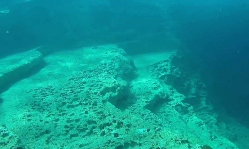
Due to that explosion, a crater was created which shelters the Vera K wreck at a depth of 11 meters underwater.Vera K wreck diving site is located very close to Yeroskipou beach and is accessible by boat, 20-25 minutes from Paphos harbour.

Vera K wreck features many fascinating areas to explore such as the partly intact bridge. Very close to the wreck, divers will find a beautiful and colourful archway as well as a number of narrow tunnels. In addition, there is plenty of sea life for observation. Exploration of the narrow tunnels is recommend only for experienced divers even though this diving site is ideal for all levels.

Open water qualification (OW) required.

Vera K wreck diving site video: 
Vera K wreck diving site location map: 

Near Vera K wreck diving site

Other places within a short drive, closest first.

Nearby Places and things to do (within 5 km radius)

Nicosia

Machairas Forest

The Machairas Forest has an extent of 6.057 hectares or 60, 6 square kilometres.

Nicosia

Prophet Elias Picnic Site

The Prophet Elias picnic site is located at the Lythrodonta- Vavatsinia road through the Machera forest, 8 km from Lythrodonta, next to the Prophet Elias Monast

Nicosia

Machairas National Forest Park

The Machairas National Forest Park is located in the area of Machairas in the Nicosia district. The aim of the park the protection and proper use of the prec

Nicosia

Mantra tou Kambiou Nature Trail

Location: Macheras – Kionia District: Nicosia Starting Point: Mantra tou Kambiou Picnic Site in the Macheras Forest Length: 1 kilometre Time: 0,

Nicosia

Mantra tou Kambiou Picnic Site

The picnic site of Mantra tou Kambiou is located at the Kapedes-Machera Monastery road, 5km from the Kapedes village in the Nicosia district. Altitude: 660 m

Pages