Troodos Forest
The Troodos Mountain Range is the geological and morphological backbone of Cyprus. The Troodos Mountains are covered with forests which have unique natural beauties and accommodate precious plant and animal habitats as well as graphic villages which maintain many of the traditions of the area. To the west it begins from the Paphos district and to the east it extends to the Limassol, Nicosia and Larnaca districts.
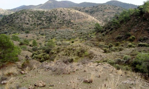
In the heart of the mountain range is the Troodos forest with the highest peaks (1952 m). Its largest part is around 9,300 hectares or 9, 3 square kilometres and has been proclaimed as a National Forest Park in 1992. The aim of the proclamation was to maintain and evaluate its precious operations and values: ecological, scientific, hydrologic, and recreational and tourist.
Geographical position
To the north the park reaches the Kakopetria – Prodromou main road , to the west until the villages Lemythou – Agios Dimitrios – Pano Platres , to the south it reaches the villages Moniatis – Pelendri and to the east it reaches until the main road of Fylagra – Kato Amiantos – Kakopetria.
Administration - Management
The whole park is a national forest and is owned by the government. The administration and management of the forest is under the jurisdiction of the Forest Department of the Ministry of Agriculture, Natural Resources and Environment.
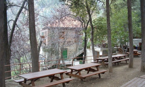
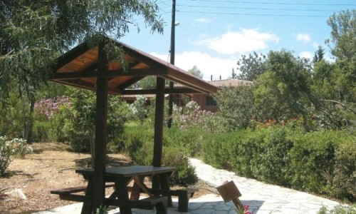
The Platania forest station is the main management of the park. There are also forest stations in Pano Platres , Saitta , Troodos and Pano Amiantos. The main forest responsibilities are its protection from fires, the maintenance and improvement of the picnic areas and nature trails, the management of the forest ecosystem and habitat and the maintenance of the forest road network.
Flora and Vegetation
The forests in Troodos are mainly made up of natural forests which renew themselves without the interference of man. The lower altitude areas are covered by the common pine trees (Pinus brutia) which extend up to 1200 metres, while the southern parts of the forest can reach 1500 metres. A large number of smaller trees and bushes take over particular ecological “nests” of the forest ecosystem, which are created according to the altitude zones, as well as other ecological parameters such as geology and moisture.
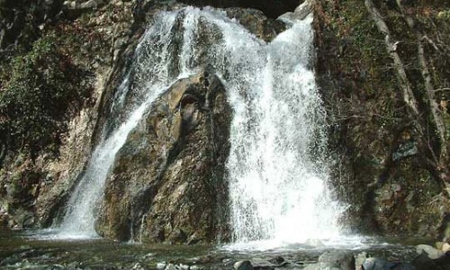
Near the rivers there is thick plane tree vegetation (Platanus orientalis), hardwood trees (Alnus orientalis) and laurel trees (Myrtus comunis) which add a variety to the location and offer an ideal refuge for wildlife.
At the lower altitude areas one can find the wild olive tree (Olea europaea) which extends up to 1000 metres, the arugulas (Arbutus andrachne), with its beautiful colour changes extend from 600 metres until 1500 metres, the oyster (Rhus coriaria) and the endemic lagoia (Quercus alnifolia) extend from 600 metres until 1650 metres.
At the higher altitude areas of the forest, the pine tree forest is made up of the black pine trees (Pinus nigra), which reaches until the Chionistra area. It coexists with the psychotropic bushes such as the aoratos (Juniperus foetidissima), the wild apple tree (Sorbus aria), the wild quince tree (Cotoneaster racemiflorus), the barberry (berberis cretica), the endemic rasiin (Genista sphacelata ssp. Crudelis) and others.