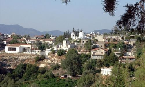
Tsada village
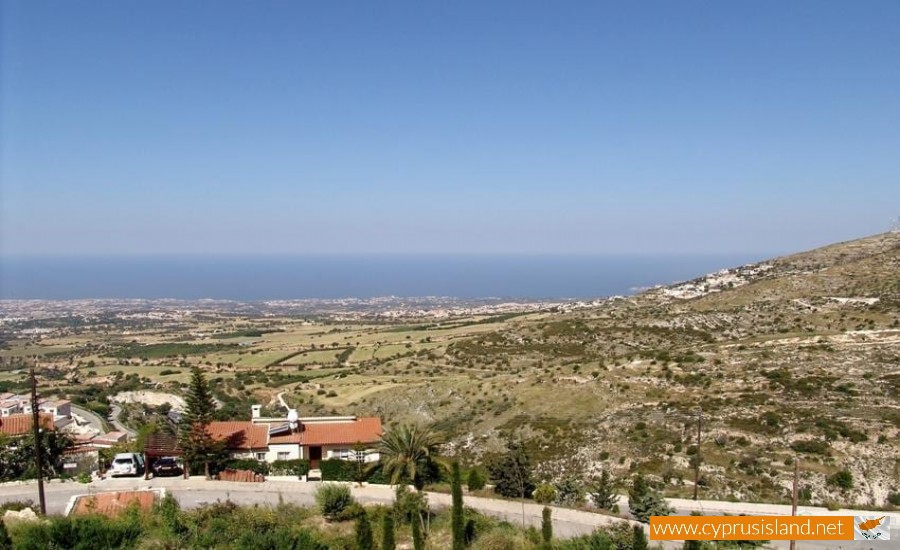
Tsada is considered a large village in the Paphos district in Cyprus and it is about 10 kilometres away from the town of Paphos.
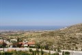
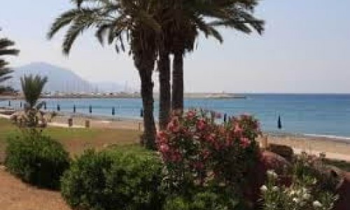
The community is built at an average height of 600 metres and has an average yearly rainfall of about 610 cm. Due to its altitude, Tsada’s climate is cold in the winter but cool during the summer months and mainly does not have any moisture which is one of the main problems of Paphos. The community is comprised by about 1000 residents, local and foreign. To the northeast, Tsada borders with the villages, Kallepia (3.5 kilometres), Letymbou(6 kilometres), and Polemi (8 kilometres). It is also connected to the west with the main road Paphos-Polis from which it is only 1 kilometre away. To the south is borders with the village Armou (6 kilometres). To the southwest it borders with Tala and the Agios Neophytos Monastery.
Residential Details
The village met a continuous residential increase from 1881 until 1946. In 1881 the residents were 383, which then increased to 439 in 1891, to 536 in 1901, to 650 in 1911, to 712 in 1921, to 742 in 1931 and to 953 in 1946. In 1960, the residents decreased to 907, increased to 909 in 1973 but decreased to 878 in 1976 and to 815 in 1982. In the inventory during 2001 the residents were 680. The village is not mentioned in medieval sources, at least not with the name which we know it as today. Therefore we can conclude that it is a new community. In the area, many old maps have a village with the name Coria which existed during the medieval years. Evidence of a small community between Tsadas and the Saint Neophytos monastery exist however it is not known to which community it belonged to.
Occupations
Vine cultivation existed from the older years, as the main and basic source of income for most residents in the community. Apart from the vineyards, in the area they also cultivated wheat, carob trees olive trees, walnut trees, a few fruit trees (oranges, apples, pears) and very few vegetables and lentils.
Name
In concern to the name of the village, there is no positive information. There are many versions which are said by the villagers. However the one which is said by most in the one which has been told from the older generations. During the Turkish period the village which was built in the lower areas, was attacked constantly by the Turks. That is why the residents decided to move the village “Tsa-da” (a little bit over there) as they would say then, and that is how Tsada received its name. According to others the name of the village come from a plant called “avrosilla” which has thin branches which are used to make a “vitsa” and therefore the village was named Vitsada. It was later shortened to Tsada. However this version seems quite farfetched. It may also have come from the name of the first villager and the name may also have been altered without knowing the original name. A peak at the west of the village is called Tsiarta and this may also have a connection with the name of the village.
The local tradition however states that the name of Tsada must have come from an earlier migration of the village. In particular the older village of Kouria was constantly raided by the Sarakinians. In one of their raids, some villages ran into the mountains while the elderly hid in a nearby cave where their water ran. The Sarakinians however found them, then they tied them and brought them back to their village where they were then slaughtered. Whoever survived the raid wandered in the nearby villagers looking for a safer place to live. A place where they would have a warning in case of another raid. Searching for the right place they said a little more over there which in Greek is “Tsa da para pano” which is where the name finally originated from. In order to back up this theory, there are two hills to the left and to the right of the village which were used as lookout point towards the sea. Tradition says that the lookout point were actually used and that during the next raid the villagers had enough time to hide in a nearby cave near the old road of Tsada – Koilis , at the point which the mountain was cut in order to build the new road towards Polis. During the raid, the villagers were in a hurry to leave and forgot the blind violin player behind. The Sarakinians found him and took him with them in order to entertain them with his violin while they searched for villagers. At some point while the Sarakinians were entering the cave, the violinist heard a baby crying and in order to warn the mother to make it be quiet he sang a song which had a warning in it. The Sarakinians were suspicious of the violinist and asked him what the words meant. He told them that they were only the words in the song. It is unknown if the musician survived the adventure but the villagers were saved.
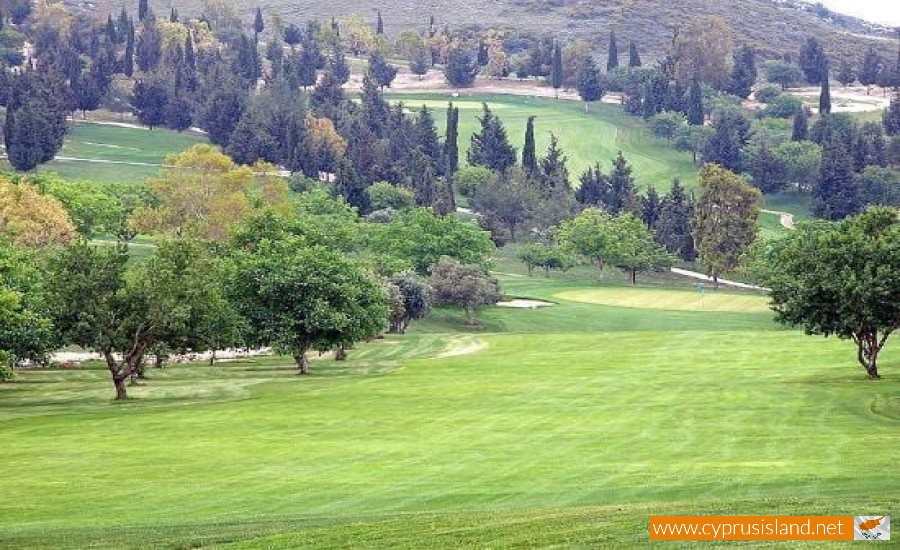
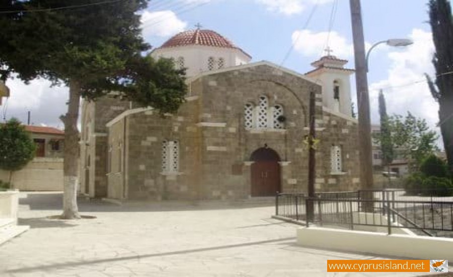
Sightseeing
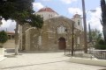
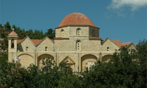
In the community of Tsada there are, the Church of the Virgin Mary Chryseleousa, the monastery of the Cross of Minthis , and the chapels of Agia Marina , Saint Kontantinou and Eleni as well as the Agiasma of Agia Eleni. In the village a visitor can see the monastery of the Cross of Minthis, the old stone built water springs (Gerolakkos , Rodkios and Piathkia), and the main church village Virgin Mary Chryseleousa with the miracle icon. In the village visitors can also see the museum which is also the house of Evagoras Pallikarides , and the stone built winery.