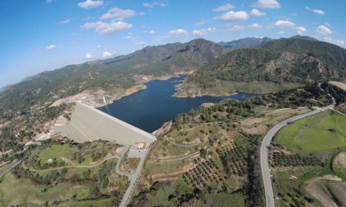
Mavrokolympos Dam
Hidden amidst gently rolling hills near the village of Mavrokolympos, this quiet reservoir brings a sense of calm few places can. A short drive from Limassol yet enveloped in solitude, Mavrokolympos Dam is a retreat where water, land, and light come together in a subtle, lingering harmony.
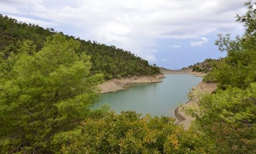
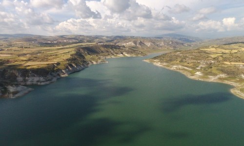
A Reservoir Shaped by the Land
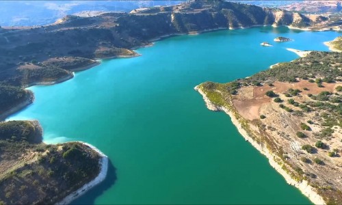
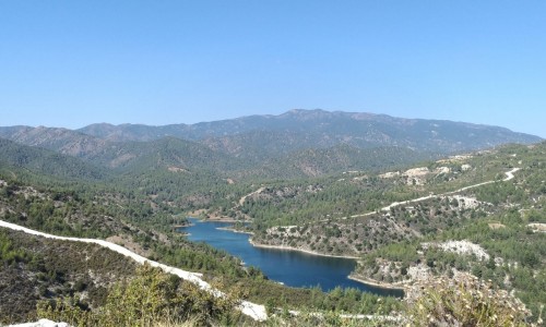
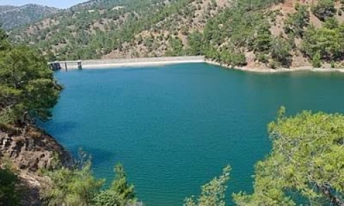
Mavrokolympos Dam lies in a shallow, bush-lined valley, its surface a clear, still canvas reflecting cedar groves, scrub hillside, and sky. Rainwater and seasonal runoff fill its basin, forming a gentle pool bordered by reeds, wildflowers, and soft grassy slopes. Far from imposing dams or riverside promenades, this is a reservoir that seems to have grown from the land rather than imposed upon it.
Getting Close to Quiet
Walking here feels simple, natural, and grounding. A few informal footpaths lead from the nearby road to the water’s edge, where benches offer shade and quiet. Wildflowers bloom in spring, cicadas hum through summer, and in autumn the trees shimmer gold. On sunny afternoons, long shadows stretch across the water. You might see frogs swimming near the bank, dragonflies skimming the surface, or small birds perched on reeds—each movement gentle and deliberate.
Though few visit on purpose, the dam welcomes those who do: solo walkers with daypacks, couples on quiet hikes, or families stopping for a picnic by the reeds. No commercial facilities; only quiet peace.
Your Day at Mavrokolympos
- Early Morning: Mist drifts over still water, birds loop overhead, and sweet air drips from trees. A perfect moment for meditation or soft stretching.
- Midday: Visitors arrive—often locals or nearby villagers. They find shady spots, lay out snacks, read or reflect. The dam’s calm feels like a slow wash, refined and gentle.
- Late Afternoon: Light softens, the air cools, and reeds rustle softly. It’s perfect for photography or quiet conversation. The water takes on the deep blue of early evening as everything begins to hush.
Who Will Be Drawn to Mavrokolympos?
- This place suits:
- Nature lovers wanting solitude and low-key beauty
- Local explorers looking for natural stops near Limassol
- Walkers and hikers who favor unpaved paths in quiet terrain
- Artists or writers inspired by still water and landscape reflections
- Travelers craving calm, without crowds or expectations
It’s not a place for swimming or boats—but it does provide deep rest for mind and spirit.
Visiting Tips
- Bring water, snacks, and sunshade—there are no facilities on site.
- Wear soft walking shoes—the paths are natural and can be uneven.
- Visit early or late for best light and serenity.
- Respect nature—leave nothing behind, disturb nothing.
- Pair your visit with local trails, woodlands, or a peaceful stop in Mavrokolympos village itself.
Mavrokolympos Dam stands as a gentle reminder that beauty doesn’t always need to shout. It is a place uncluttered by expectation, where time slows and nature’s rhythm hums underfoot.
If you pause long enough, you begin to feel it: not escape, but a kind of return—to clarity, quiet, balance. And in Cyprus, that quieter rhythm is among the rarest and most generous experiences of all.
Name: | Mavrokolympos Dam |
Location: | Paphos District |
Year built: | 1966 |
River: | Mavrokolympos |
Purpose: | Irrigation |
Type: | Dirt |
Dam category: | Large |
Capacity: | 2.180.000³ |