Oroklini Village
Nestled on the southern coast of Cyprus, Oroklini—sometimes called Okoklini—is a village that balances the charm of traditional Cypriot life with the conveniences of modern living. Just a short drive from the bustling city of Larnaca, it feels like a retreat where the sea, the hills, and the village square all tell their own stories.
A Village with Deep Roots
Oroklini’s history stretches back centuries, shaped by agriculture, shepherding, and the rhythms of village life. Narrow lanes wind between stone houses, some lovingly restored with bright blue shutters and blooming bougainvillea, while others remain faded and rustic, carrying the memory of another era.
Though the village has grown in recent decades, welcoming newcomers from Cyprus and abroad, it still retains its core identity. Family-run tavernas, old chapels, and community gatherings keep alive the sense that Oroklini is more than just a place to live—it is a place to belong.
The Landscape
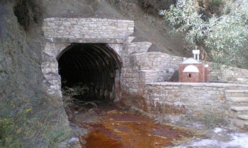
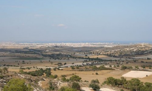
Oroklini is embraced by both land and sea. To the north rises Oroklini Hill, a green slope that invites hikers and walkers to climb for sweeping views of the Larnaca coastline. In spring, the hill is carpeted with wildflowers, while in summer, it offers breezy paths above the heat of the plains.
To the south lies Oroklini Lake, a small but significant wetland and nature reserve. Here, migrating birds find rest during their journeys across continents. Flamingos, herons, and ducks are among the seasonal visitors, making the lake a tranquil spot for birdwatchers and anyone who loves quiet moments in nature.
Just beyond the lake, Oroklini Beach stretches out with golden sands and calm, shallow waters. It’s a favorite for families, thanks to its easygoing atmosphere, but it’s also loved by those who simply want to dip their toes in warm Mediterranean waters after a walk through the village.
Village Life and Culture
Life in Oroklini has always revolved around the community. The heart of the village is its central square, where people gather at small cafés and tavernas. In the evenings, the square fills with conversation, the clinking of glasses, and the aromas of grilled meats. Cypriot meze—small plates of local dishes ranging from halloumi to souvlaki—is the village’s signature style of dining, encouraging visitors to linger over their meal.
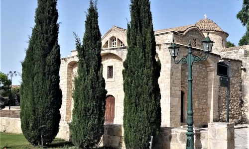
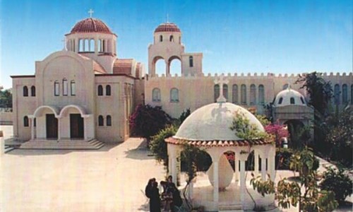
Oroklini is also home to several churches and chapels, each with its own history. The Church of Archangel Michael, with its whitewashed walls and bell tower, is a focal point for religious celebrations. On feast days, the village comes alive with processions, music, and traditional dances, as families reunite and visitors are welcomed to join in the festivities.
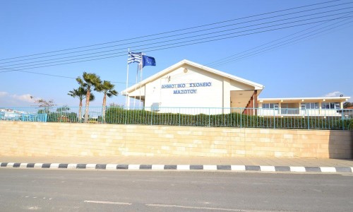
Despite modern additions—supermarkets, bakeries, and new housing developments—Oroklini has kept its soul intact. Shepherds can still be spotted leading their goats along old paths, olive groves border the outskirts, and the village bakery continues to be a hub of daily life, its shelves filled with fresh bread and pastries each morning.
A Taste of Oroklini
Food is at the heart of Oroklini’s appeal. Traditional tavernas serve dishes prepared with recipes passed down through generations: slow-cooked kleftiko, sizzling sheftalia, and meze spreads that seem endless. Local wines, zivania, and Cypriot coffee complete the experience, making every meal not just nourishment but a celebration of place and culture.
For those who prefer a lighter pace, modern cafés and seaside restaurants near Oroklini Beach offer Mediterranean flavors with a view of the waves. This mix of old and new dining styles mirrors the village itself—rooted in tradition, yet open to the present.
A Place Between Worlds
Oroklini is neither fully rural nor fully urban—it exists in a space between. Its proximity to Larnaca makes it convenient for those who work in the city, yet the village itself offers a slower, more grounded rhythm. It is a place where mornings might begin with birdsong on the hill, afternoons with a swim in the sea, and evenings with laughter around a shared table.
For residents, Oroklini is home. For visitors, it is an invitation to experience Cyprus in its most welcoming form—authentic, beautiful, and alive with the traditions that define the island.