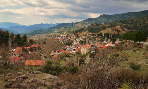
Lofou Village
Nestled in the rolling hills of the Limassol District, just a short drive from the bustling coastal city, Lofou is a village that feels beautifully removed from the pace of modern life. With its winding stone-paved alleys, preserved architecture, and serene surroundings, Lofou offers a genuine taste of traditional Cypriot culture — the kind that lingers in the scent of baked bread and echoes through cobblestone courtyards.
A Journey Through Time
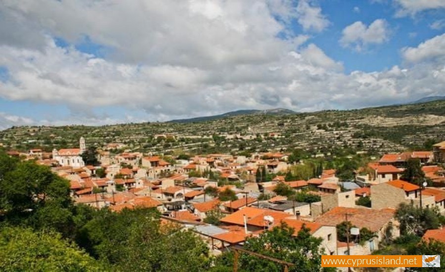
Lofou’s roots stretch deep into antiquity. Some believe it was established as early as the Byzantine period, while others point to its significant role during the Frankish and Venetian eras. The name “Lofou” is derived from the Greek word “lofos,” meaning “hill,” which makes perfect sense once you see how the village hugs the slopes of a lush hillside at an altitude of around 800 meters.
This elevated position once made Lofou a safe refuge during periods of piracy, and it later became a vital wine-producing village under British colonial rule. However, like many rural communities in Cyprus, Lofou suffered from urban migration during the 20th century, leading to a period of near-abandonment.
What makes Lofou remarkable is the way it has bounced back. Thanks to careful restoration efforts and a revival of interest in agrotourism, the village is now a model for cultural preservation and sustainable tourism in Cyprus.
Architecture & Ambience
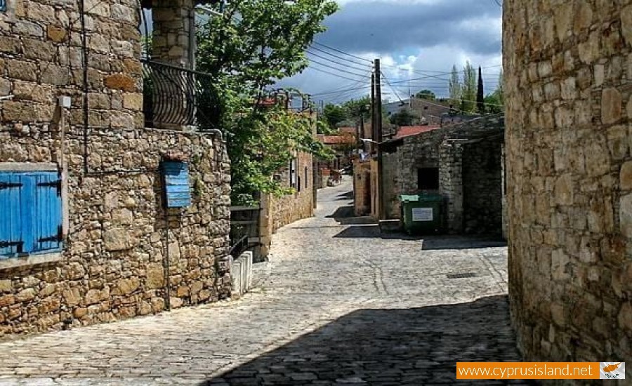
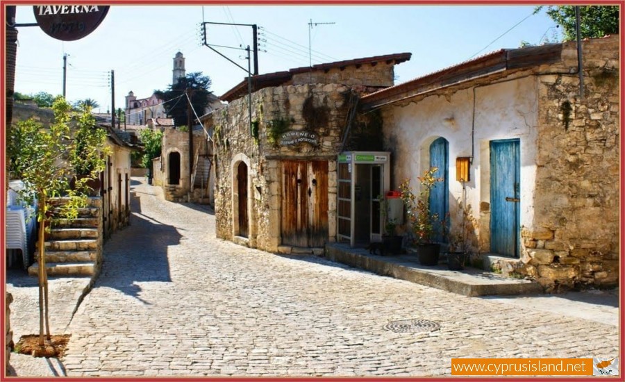
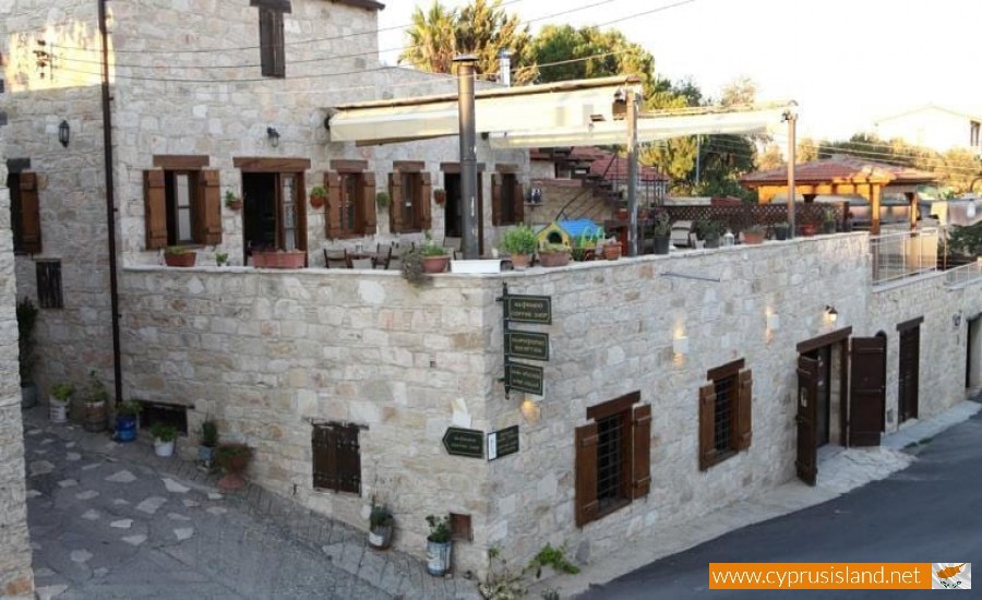
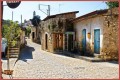
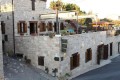
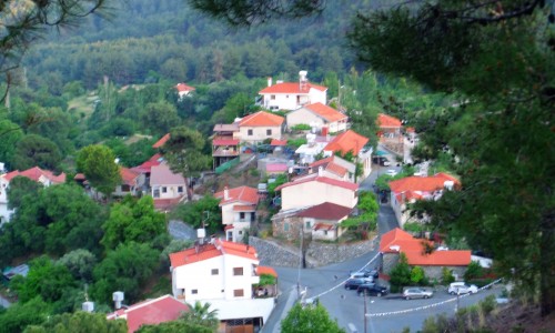
Lofou’s traditional architecture is arguably its most enchanting feature. As you meander through its narrow lanes, you'll notice the distinctive stone houses with terracotta roofs, wooden balconies, and flowering courtyards. These homes, many of which have been lovingly restored, reflect the authentic rural life of past generations.
The layout of the village itself is a testament to clever design — built in a circular shape around the central hill, it offers stunning panoramic views of vineyards, olive groves, and distant mountain peaks.
Every corner of Lofou seems like a postcard: crumbling walls overgrown with bougainvillea, intricately carved doors, sun-dappled patios, and locals tending to their gardens or chatting under the shade of ancient trees.
Religious Heritage
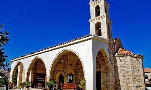
At the heart of the village stands the grand Church of the Annunciation (Panagia Chrysolofitissa), a 19th-century stone-built basilica that dominates the skyline. Its intricate iconostasis and tall belfry are impressive, but what makes the church truly special is the story behind it: it was funded and built by the villagers themselves, a testament to their deep religious faith and communal spirit.
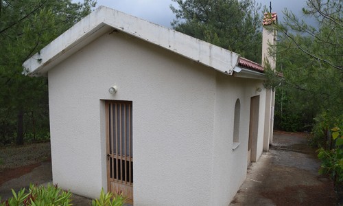
Surrounding the main church are several smaller chapels, some tucked into the hillside, such as Agios Georgios and Agia Marina, which are still used today for annual feast days.
Cultural Experiences
Lofou is a place where culture isn’t curated — it’s lived. Throughout the year, the village hosts traditional festivals, particularly during Easter and August, when expatriates return, and the streets come alive with music, food, and dancing.
Don’t miss the Lofou Traditional Feast (Panigyri), usually held in mid-August, featuring live folk music, souvla grills, and local wine flowing freely under the stars.
If you visit outside the festival season, the Lofou Museum offers a glimpse into village life as it was: with exhibits of agricultural tools, kitchenware, textiles, and everyday objects from a bygone era.
Taste of the Land
Food in Lofou is a slow, flavorful affair. The village is known for producing Commandaria (the world’s oldest named wine still in production), honey, olives, and arkatena — a type of aromatic rusks made with chickpea yeast.
Many of the traditional homes now function as family-run tavernas or guesthouses, where you can enjoy authentic Cypriot cuisine: grilled halloumi, village sausages, koupepia (stuffed vine leaves), and kleftiko (slow-cooked lamb in a clay oven). Local wine and zivania (the island’s fiery spirit) often accompany every meal.
Agrotourism & Relaxation
Lofou has embraced the agrotourism movement, making it an ideal destination for travelers seeking peace, nature, and authenticity. Charming stone-built guesthouses offer cozy stays with fireplaces in winter and vine-covered terraces in summer. Some even have jacuzzis with mountain views.
There are hiking trails that lead from the village to nearby valleys and monasteries, including the scenic route toward Moni, Doros, and Vouni villages. These walks are especially magical in spring, when wildflowers blanket the hills and the scent of herbs fills the air.
Getting There & Staying Awhile
Lofou is about a 30-minute drive from Limassol and a little over an hour from both Paphos and Nicosia. The road winds through some of the island’s most scenic countryside, making the journey part of the experience.
While Lofou can be visited as a day trip, it’s best enjoyed over a weekend. Staying overnight allows you to soak up the atmosphere when the village quiets down in the evening — perfect for stargazing or a moonlit stroll through the silent streets.
Lofou isn’t just a village — it’s a feeling. A place where time slows, and every stone tells a story. Whether you’re a history enthusiast, a lover of nature, or simply someone seeking a quiet retreat, Lofou offers a soulful connection to Cyprus’ heritage and hospitality. Come with curiosity, leave with calm.